Pages

Monday, December 15, 2014

Bald Knob - Turtleback: 12-5-2014

Mileage: 6.45
Elevation gain: 1717'
Trails used: Shannon Brook Trail, Bald Knob Cutoff, Bald Knob Trail, bushwhack, Turtleback Mountain Trail, Turtleback Summit Trail, Brook Walk Trail, road walk.


The day was going to be wet and miserable.  We had planned to do the Mount Langdon traverse up in Bartlett, New Hampshire but with very icy conditions and snow forecasted we decided to stay south and play it safe.  We discussed doing some Belknap peaks or Ossipee's  and Ossipee's won out.

The Ossipee Mountains are the remains of an ancient ring dike and the various peaks that comprise the Ossipee's are located in New Hampshire in Tuftonboro, Moultonborough, Tamworth, Ossipee, and Sandwich.  Mount Shaw is the highest peak in the Lakes Region and in the Ossipee's but we did not go there on this hike.  Many of the trails are old carriage roads and seven of the Ossipee peaks are on the Castle in the Clouds property.  For more information for the Castle in the Clouds, go here.


After we parked the car at the hiker parking area off of NH 171, we headed up the red blazed Shannon Brook Trail on fresh snow which covered recent tracks of people before us.


After a short walk on the Shannon Brook Trail, we took the Bald Knob Cutoff up to the junction of Bald Knob Trail.


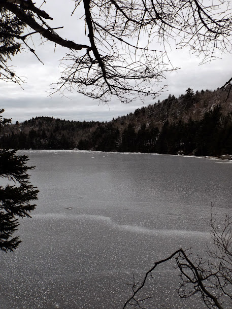
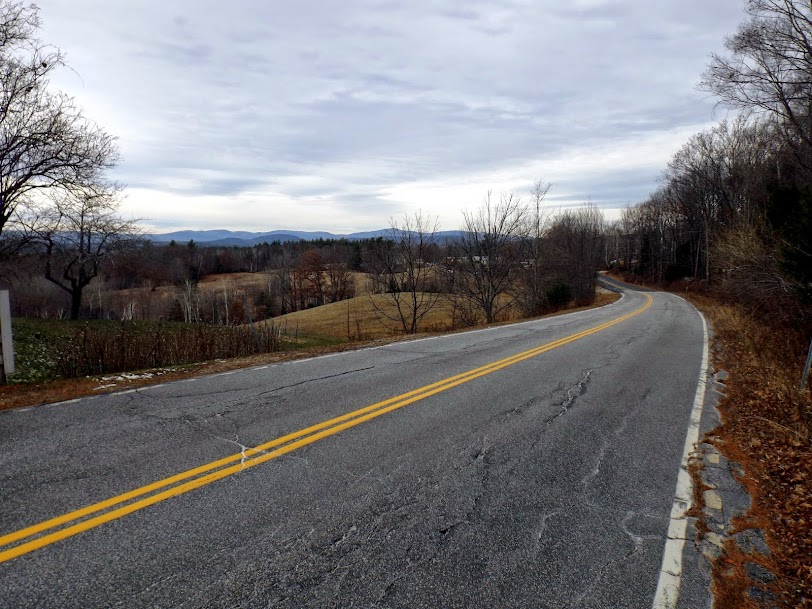
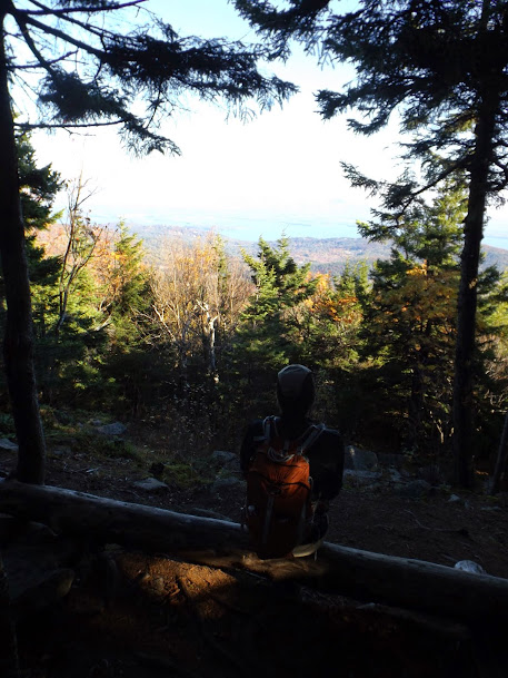
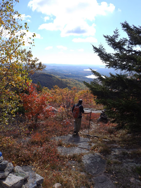
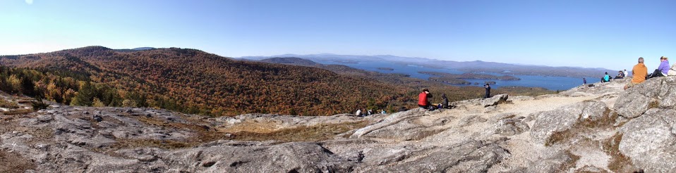
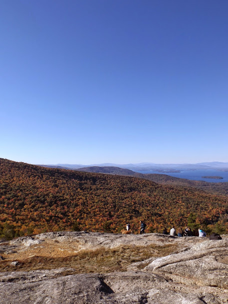
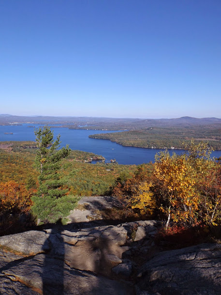
The views for the day.  We knew with the weather we would probably not get any views at all and early on from this section along the Bald Knob Cutoff, it didn't look promising.


A section of the Bald Knob Cutoff.  This yellow/blue blazed trail uses a few switchbacks to get up to the Bald Knob Trail.


Information on columnar jointing, which is somewhat visible on the rocks in the upper right corner of the picture.


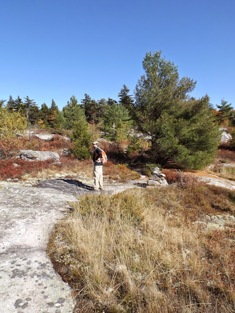
We decided to take the Bald Knob Trail to Bald Knob, even though we both had been there several years prior when we did Mount Shaw in winter.


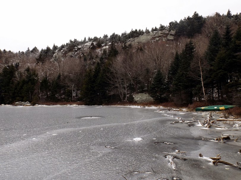
Look!  Still no views along the Bald Knob Trail, which is an old carriage road.


The clouds started parting for a few minutes and I was able to get a view of the Castle in the Clouds mansion.


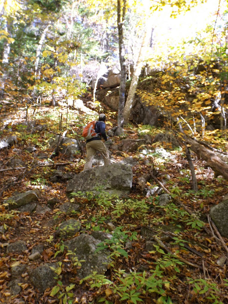
Bald Knob elevation sign with Turtleback Mountain in the background which would be our next objective.  We decided we would bushwhack up instead of going back down the trail and then taking the Turtleback Mountain Trail up which zig zags its way to the summit.


Looking back towards the Bald Knob area.  I had followed an old trail and what looked like someone else's old tracks up to the Turtleback Mountain Trail.


Mount Shaw, in the clouds from the summit of Turtleback Mountain.


Brian just below the summit of Turtleback Mountain.  At this point, it was raining so it was time to call it a day and head back down.


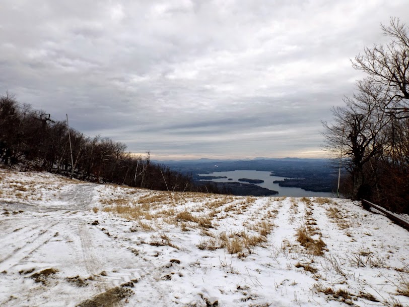
Mount Roberts decided to make an appearance.


We followed the Turtleback Summit Trail back down to the Turtleback Mountain Trail.  We would have followed it down further if not for all the switchbacks which makes it seem a lot longer than the mileages listed.


Shannon Brook from a bridge along the Shannon Brook Trail.


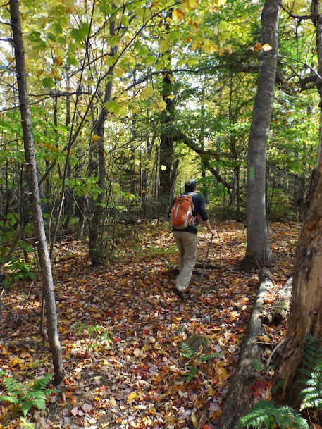
We decided to take the Brook Walk out.  From the Shannon Brook Trail, it goes down rather steeply besides Shannon Brook.


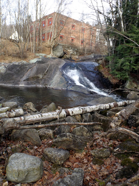
Brian heading down the boardwalk that leads to the Falls of Song.


Information on the Falls of Song along the boardwalk.


The Falls of Song was in full effect today, as it was flowing pretty good.


An enormous glacial erratic on the road heading in towards the Falls of Song area.


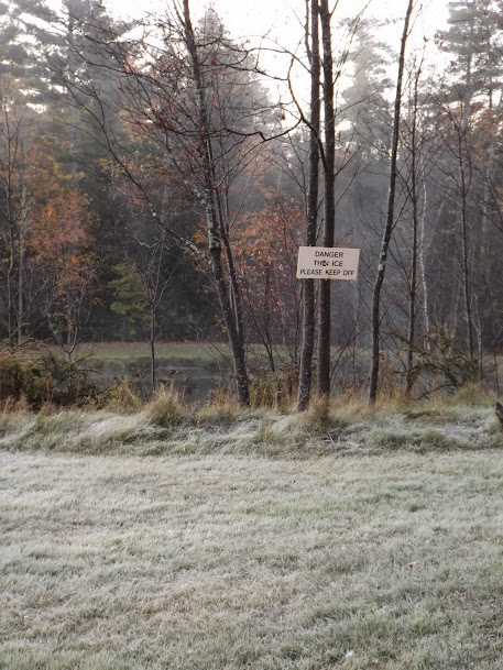
The Castle in the Clouds entrance, which is closed for the season.  We had to either hop the rock wall or walk around it down by the water (which we did).


The least productive day I think we've had this year thus far, but we'll blame it entirely on the weather.  In our attempts to hopefully go farther north and it be snowing, it instead rained on us for the entire trip down.  This made for bad views and with us being wet to the bone and cold, it also made for a poor hike.  

With good weather, this is actually a nice hike.  In winter, its almost entirely on snowmobile trails and in summer....well, summer is summer so that's another 5+ months away at this point.  


Already donated but want to do more? Can't donate but still want to help? "Like" and "share" our Facebook page. Even as little as a dollar helps. Even "sharing" with just one person does too by spreading the word. Our Donation Page is set up directly through the National Multiple Sclerosis Society website, so you can donate with confidence that 100% of the money goes to this fine collection of people working to help those stricken with MS.


Thursday, December 4, 2014

Mount Sunapee - Section 1 and 2 SRKG

Mileage: 15.45
Elevation gain: 2647'
Trails used: Roadwalk, Andrew Brook Trail, Solitude Trail, Summit Trail, Sunapee-Ragged-Kearsarge Greenway.


Mileage, that was the name of the game for today's hike.  The weather was supposed to be somewhat decent; not warm or sunny but a bit better than the prior days cold windy day.  We kicked around doing something either along the SRKG or MSG (Monadnock-Sunapee-Greenway) as they can be broken down into sections of really good lengths and we could string several sections along.  We decided on doing the first two sections of the SRKG.

The Sunapee-Ragged-Kearsarge Greenway, or SRKG as it is referred to, is roughly 75 miles of hiking trails that makes a loop around the Lake Sunapee area and connects the three mentioned mountains.  More information on this hike and the volunteers who keep it maintained, visit their website at http://www.srkg.com/.  

Most of this hike is varied; some road walking on paved roads, some old woods road walks and actual trails.  Please print a map of the section you are hiking as it can be a bit confusing in spots.


The Historical marker for the Newbury Meetinghouse, right around the corner from where we spotted Greg's car to start the hike.  


The hike starts you off by walking down Route 103.  The only problem was that we were heading in the wrong direction (which we didn't realize until too late).


You pass this war memorial in downtown Newbury, honoring all of our branches of the military and the men and women who sacrificed their lives for this country.


Since we missed the Newbury Trail, which neither of us could figure out at the time where to go to get to the trail head, we pretty much walked all the way to Mountain Road and took the Andrew Brook Trail to Lake Solitude.


Down low there was a coating of snow and ice, and this water crossing is the most challenging part of the hike we would encounter all day.


Eventually we made it to Lake Solitude, which lived up to its name. The lake is a bit different than it was when Brian was here this past summer with his friend Jim.  At that time, the lake was swarmed by at least 100 people.


The White Ledges over Lake Solitude.  It was too dangerous to head down the ledges as the snow was sheer glare ice.


From Lake Solitude to the summit of Mount Sunapee, you follow the Solitude Trail up which follows part of the access road which Greg is approaching.


At least there are some views to be had from the ski trails.


Zoomed in picture of Mount Kearsarge (right) and Ragged Mountain (center).


Panorama views from the ski slopes of Mount Sunapee.


We had to walk besides the snow guns to make it to the summit ski area which made it feel like winter (which is right around the corner).


The views looking south from the deck of the summit ski building.


We headed down the Summit Trail, which seemed to have less snow and ice than the other side. Further down the trail is an old jeep road.


The trail runs along side the beginner's ski area for Mount Sunapee, which had a good base of snow ready for skier's.


We are now doing a long road walk on Brooks Road.  You have to be VERY careful here as the SRKG blazes/markings are very far and few between making you wonder often if you are still going the right way.  We got some nice views of Croydon Peak and Grantham Mountain and Mount Ascutney in Vermont.


A short road walk back down Route 103 leads you to this next branch of the SRKG on Harding Hill Road.


After a brief road walk again, it was time to head back into the woods.  The trail runs through the Ausbon Sargent Land Preservation Trust area.  For more infortmaion such as backround history and hiking maps, visit http://ausbonsargent.org/.


This section of trail was perhaps the easiest section to follow as it was well blazed.  It was also a nice woods walk along snow mobile trails and various old logging roads.


A short bout of more roadwalking along Hells Corner Road and it is back into yet more conservation land, which the SRKG has roughly a mile of trail through this property.


Beaver dam on this watershed area of the Frank H. Simpson Preserve.


Brian hugging a utility pole on our crossing of Stagecoach Road.


The section of trail around Blaisdell Hill got a bit confusing as there were several blazes pointing in several different directions.  You DO NOT want to go up Blaisdell Hill.


Eventually the trail lead us into downtown Sunapee and right besides this cool looking covered bridge.  There is a parking lot on the left that the trail goes through (not in picture).


Greg walking over the bridge on the Sunapee River Walk.  We actually double backed up the trail to complete this section since we missed the blaze.


The SRKG comes through this grassy area and seemed almost out of place.


A neat little waterfall below the hydro plant and along the grassy area above.  It is probably a nice spot to relax on a warmer day.


Mileage mission accomplished for the day.  We probably could have added a few more miles on as it was early when we finished but we were hungry and headed into Newbury for some Mexican (found a little place near the local airport that wasn't bad).  

A mixed bag on this hike.  Like usual, when we gather information we do a poor job of it and the route finding of the route was the hardest part of the day.  Some spots were blazed nicely with the white blazes or cut out blazes indicating the SRKG; other sections we really had to "hope" we were headed in the right direction.  If you decide to do this in sections, or even in its entirety, please download and print a map.  It will definitely save you some trouble!

Otherwise, not a bad day.  It was a bit chilly when the wind picked up on the road sections we hiked on but if you aren't looking for a view-centric kind of hike, this hike is for you.   


Already donated but want to do more? Can't donate but still want to help? "Like" and "share" our Facebook page. Even as little as a dollar helps. Even "sharing" with just one person does too by spreading the word. Our Donation Page is set up directly through the National Multiple Sclerosis Society website, so you can donate with confidence that 100% of the money goes to this fine collection of people working to help those stricken with MS.


Sunday, October 26, 2014

*ALMOST* Belknap Traverse: 10/11/2014

Mileage: 16.55
Elevation gain: 4276'
Trails used: XC ski trail, Ridge Trail, White Trail, Old Piper Trail, Boulder Trail, Round Pond-Piper Link, Round Pond, Mt. Klem-Mt. Mack Loop, Red Trail, Anna-Straightback Link, Quarry Trail, Major-Straightback Link, Main Trail.


So, I don't think Brian understood what I wanted to do in the Belknap Range but he seemed to go along with my plan anyways.  It seemed like the perfect time to try and hit all 12 Belknap Range peaks in one day as it was going to be cooler to start and a pleasant cloud-free day in the afternoon.  

The Belknap Range is located in several different towns due to its massive size:  Gilford, Gilmanton and Alton, New Hampshire.  There are 12 main peaks that comprise the Belknaps; Mount Rowe, Gunstock Mountain, Belknap Mountain, Piper Mountain, Whiteface, Mount Klem, Mount Mack, Mount Anna, Rand, Straightback Mountain, Quarry and Mount Major. There are alot of trails in this area so it would be easy to get lost so before you plan something like this, please do your homework.  Here are a few good sites to get information from: http://belknaprange.org/ and http://belknaprangetrails.org/


There is even incentive to get the little ones out hiking.  The Belknap County Sportmen's Association offers a hiking patch if one hikes all 12 peaks (you do not have to do them all in one day).  For more infomation http://www.belknapsportsmensclub.com/hiking.html


Greg getting ready with Mount Rowe behind him.  Taken from the spot right off of Area Road where we parked Greg's car to start the traverse.


Ice? What ice? It is a bit early, but this ain't so funny because of how close we are to it.  Yes that is some frost on the grass as it was a bit chilly when we started.


The moon was still out for out viewing pleasure.  Mixed with the foliage colors, it made for a scenic trip heading up the ski trails.


The summit of Mount Rowe (elevation 1680') however, is not so scenic with its communication/tv tower on its summit.


From here we picked up the Belknap Range Trail (BRT), which we would take for a majority of the hike on all the peaks we hiked to.


Continuing on our way to Gunstock, we cross this nice area on the other side of the summit with some nice views towards Gunstock Mountain(right) and Belknap Mountain(left).


This  interesting GPS tracking system was on the other side of Mount Rowe heading towards Gunstock Mountain.


This is looking down to the parking area for Gunstock Mountain from some ledges on the other side of Mount Rowe as we head towards Gunstock.


A side trail takes you to the top of a ski trail offering a small view.


Greg on the summit of Gunstock Mountain (elevation 2250'), which is a popular ski area in New Hampshire in winter.


Greg pondering why they call it the Panorama Pub.


Panorama from the Panorama Pub's Panorama...say that ten times fast!


Hmmm, which way to Belknap, I wonder.


Greg doing his best Forest Gump impression. Mama always said "life is like a box of chocolates.  You never know what you're gonna get."


The firetower on the summit of Belknap Mountain (elevation 2382').


You have to climb the tower on Belknap Mountain to get any views.  These are looking towards Mount Cardigan and Mount Moosilaukee.


The Ossipee Range, and peaks in the Waterville Valley area as well as Lake Winnipesaukee.


Hazy views into Vermont today.  You can barely see the ledges on Mount Rowe peaking out.


Even with all the signs and blazes, we still had to break out the map several times.


Looking back to the fire tower on Belknap Mountain.


Time to keep on truckin' on our way to Piper Mountain.


The trail is still easy to follow with all the cairns and blazing.


The Belknap range does offer tons of view points, like this one from the junction of the Boulder Trail and White Trail.


At the junction for Piper Mountain and to head back down to the Belknap Mountain auto road area, Greg tweaked his ankle thus ending our bid for a complete Belknap Traverse.  We waited for a bit to let the pain subside and while he tested it several times, it was a bit dicey.  Duct tape worked wonders though.  He used some to take his ankle up and we headed back the way we came; if his ankle still bothered him, we would bail the way we came up and road walk back.  If not, we would continue on.


Greg now sports a magic staff I found for him.  To show his gratitude he subsequently lost it around Mount Klem.


You just got to love those views!  Another panorama as Greg enjoys the sights.


The aptly named Boulder Trail.  Not sure why it's called that though.


A reverse view looking back the way we came.  It was slow going through this section.


Once down from the Boulder Trail, we were back on solid ground until we would hit Round Pond.  This section of trail was probably the least exciting part of the hike.


Either the tree is blazed in bright green or Kermit the frog exploded on his way to Round Pond.


It was bound to happen sooner or later; we find ourselves a Round Pond.  


You can barely see the communications tower from Belknap Mountain above the trees.


Once we made our way aROUND the pond, we would head for Mount Klem.


And what do we find?  Another view of course!


We bushwhacked to Mount Klem's summit (elevation 2001'), even though there is a trail there now. From Mount Klem it was off to Mount Mack.


On Mount Mack (elevation 1945') we find an old broken down wind generator and a tower.


Now it is time to tenderly hike our way up Mount Anna.  We found this to be another ho-hum section of the hike.


After Anna, it was off to Straightback.   Before going to the actual summit we make our way toward East Quarry by turning at this junction.


On the way to East Quarry we happen upon a view that gives us a sneak preview of what is to come on Mount Major!  The hiker ant horde scurrying around on the summit.


Views towards Red Hill, too.


Guess what?  Another view!  This one just before E. Quarry.  See, this hike has tons of views so if only you were to do one or two peaks you should have a good time on a nice day.


There is one steep section between Quarry and Straightback (this wasn't it).  


Back to Straighback we get yet another view and then we move onto Mount Major.


 The zoo on Mount Major, which is ill represented in this photo.


 The views are definitely worth it from Mount Major's summit.


Heading down the ledges to get back to the car.


The main trail up Major is so heavily used parts are seriously eroded, like this section of trail near the parking area and start of the trail.


THE END!


We fell a few peaks and about 5 miles short of our goal of doing all twelve peaks in one day because of the minor injury, but we still managed to get quite a few miles in to add to the overall tally.  It is definitely doable, barring injury, though.  Maybe we will try again sometime in the future.

It was a very nice day; cool to start and warming up as the day went by.  It stayed clear and we didn't run across too many people (maybe 10 total) on the way across until we got to Mount Major where it was the usual mixture of hiker/vacationer.  There are a lot of trails for this hike so you could have fun for some time.  Plus, it is very family/child friendly to boot.


Already donated but want to do more? Can't donate but still want to help? "Like" and "share" our Facebook page. Even as little as a dollar helps. Even "sharing" with just one person does too by spreading the word. Our Donation Page is set up directly through the National Multiple Sclerosis Society website, so you can donate with confidence that 100% of the money goes to this fine collection of people working to help those stricken with MS.


Brian and Greg say "thumbs up to all who donate, or like and share on Facebook!" Hey, even if you like being silly, like our page!