Mileage: 15*
Elevation gain: 5481'
Trails used: Greenleaf, Garfield Ridge, Gale River
Before we begin, let this be known that this hike was entirely Joe's idea (we just went along!) so any complaints on this blog are purely his fault. He wanted to hike to Galehead to see how to do the rigging for his Flags on the 48 setup, so of course we couldn't pass this high mileage up. Plus it gave us a chance to hike with Joe and provide a second car for a car spot.
This hike also gave us a chance to continue section hiking parts of the Appalachian Trail in New Hampshire. We both needed the section from Mount Lafayette, across Garfield Ridge and up to Garfield.
*our mileage differed from the AMC mileage but I am going with my total of 15, therefore possibly cheating Brian and myself of a mile or two.
We parked at the Cannon Mountain tram parking lot (for hikers) and then we walked under the highway to start the long mileage day.
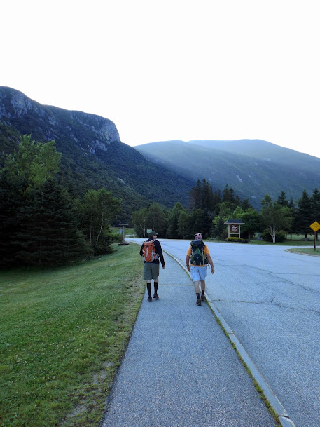
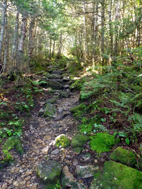
We were taking the Greenleaf Trail, which is pretty well eroded from all the traffic it sees and pretty view-less minus the views from Eagle Pass.

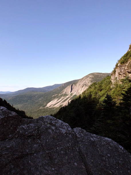
We made our way up to Eagle Pass, which is a narrow ravine-like formation in between Eagle Cliff and Mount Lafayette, and the views from here are quite stunning!

The trail makes a short jaunt through Eagle Pass.

If you look close, you can even see the tram building on Cannon from here.
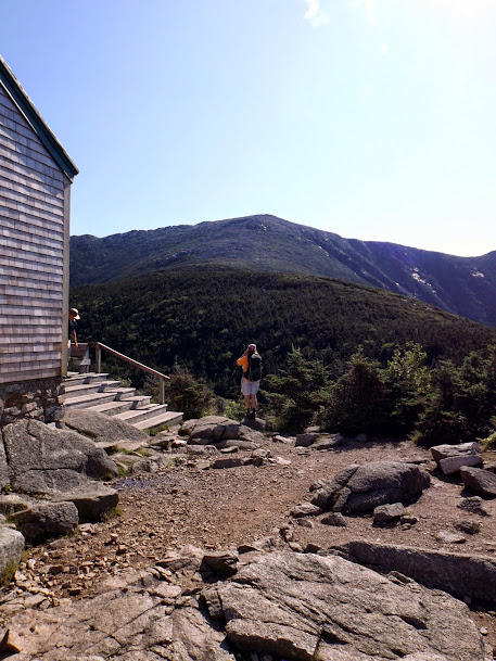
Once through Eagle pass, we started the climb up to the Greenleaf Hut, which is owned and operated by the AMC.

Brian taking a picture of Joe taking a picture of the hut (say THAT 7 times fast!)

Greg taking a picture of Brian and Joe after they took pictures of the hut (say THAT 7 times fast!)

The Greenleaf Hut. They must have known we were coming as they had set out a radiation warning sign. Or maybe it's all those smelly hikers.

The views from the hut are worth the trip alone. Joe taking a picture of what lies ahead.
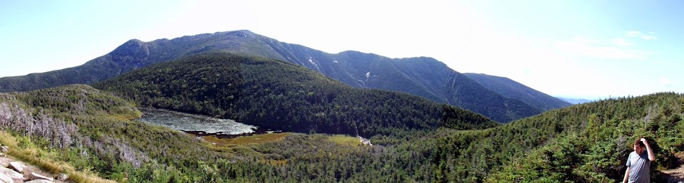
Panorama of Franconia Ridge and Eagle Lake, with some ugly guy in the picture.
As we started approaching the summit, the trees started to disappear and the distant views were becoming constant.
Looking towards Moosilaukee, the Kinsmans and Cannon.

The Cannon Mountain ski area and views into Vermont.

Oh, how we love this (and how could you not?)!

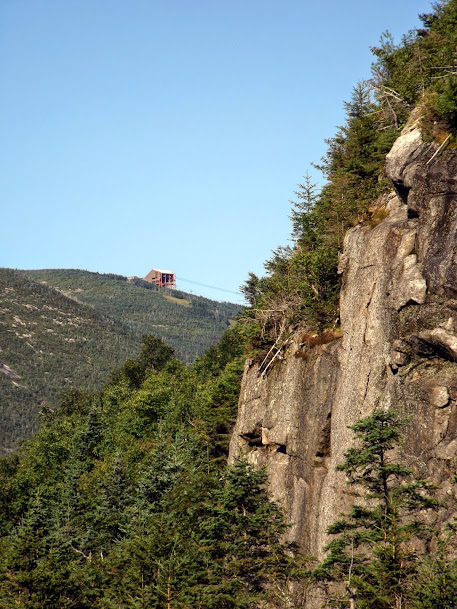
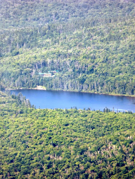
This is a super-zoom of Lonesome Lake Hut. The Greenleaf Hut and Lonesome Lake Hut are the only huts in the chain that can be seen from each other.
North Lafayette, where we would be heading soon.


Success! The summit of Lafayette, which would be the highest climb of the day. Go right, and you'll head down Franconia Ridge; to the left, the Garfield Ridge Trail/Appalachian Trail.
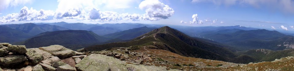
Summit panorama time. Looking down Franconia Ridge with Owl's Head on the left, Flume and Lincoln in the middle, Moosilaukee, the Kinsmans and Cannon to the right.
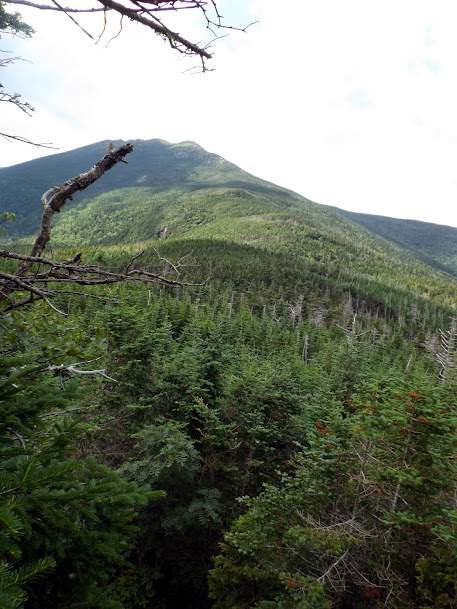
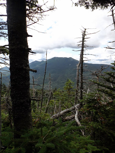
Mount Garfield, which is our next destination which involves hiking Garfield Ridge.

The obligatory Mount Lincoln summit shot from the summit of Mount Lafayette.

The summit of Mount Lafayette (elevation 5260'). Not very busy at the moment.

Brian and Joe heading down the Garfield Ridge Trail and over to North Lafayette.

The clouds moved in while we were on the summit, and stayed for the better part of the day.

Looking back towards where we came down.

Greg is singing "everybody was Kung-fu fighting, those fists were fast as lightning!" as he heads down to North Lafayette.
The trail junction for Garfield Ridge Trail and Skoocumchuck Trail.

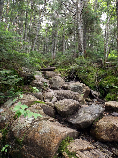
Another shot of Mount Garfield ahead. The stretch of the Garfield Ridge trail we will use is notorious for being a tough hike.

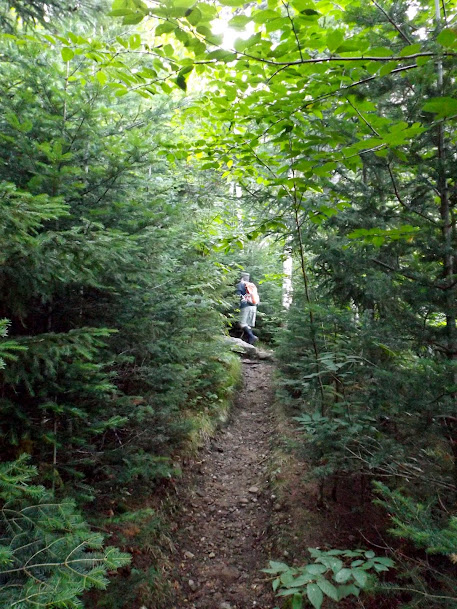
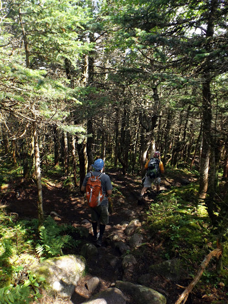
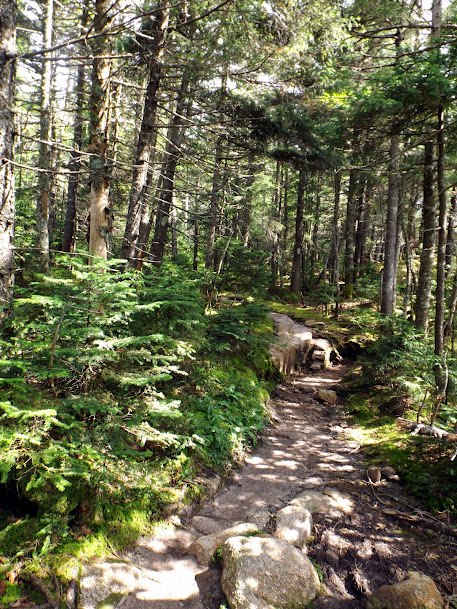
Once back into the woods, we have quite a ways to go on the spruce heavy ridge, complete with a good amount of rolling bumps to go up and over.

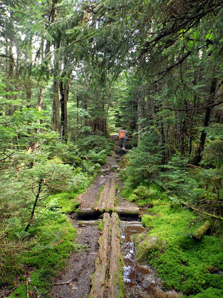
Bog bridges do help with some of the muckier spots.
Looking back at Lafayette. Yes, we came from all the way over there.
On the approach to Garfield you pass by Garfield Pond, which is reached by a short path.


The final steep pitch to the summit is about 500 feet of elevation gain from Garfield Pond.

Another look back at Lafayette, which now appears pretty far away.
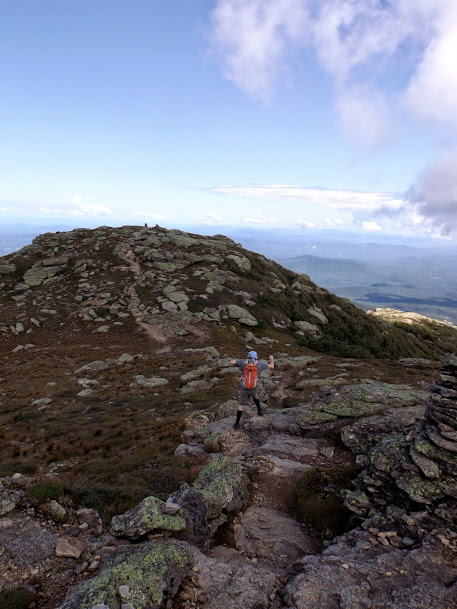
Almost to the summit of Garfield.

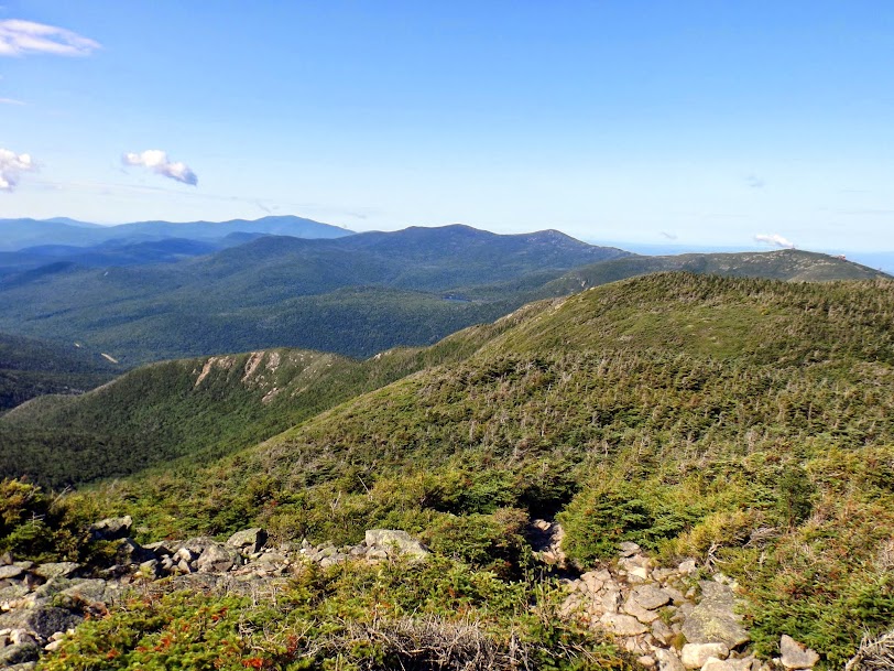
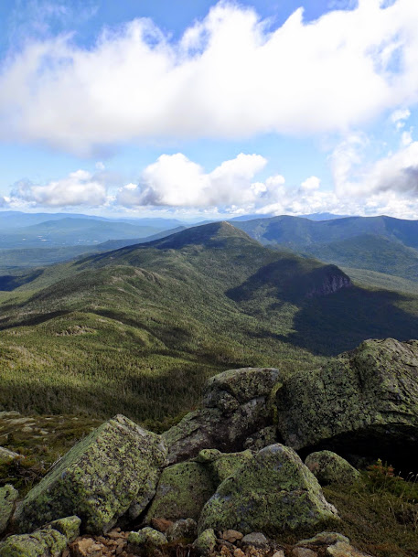
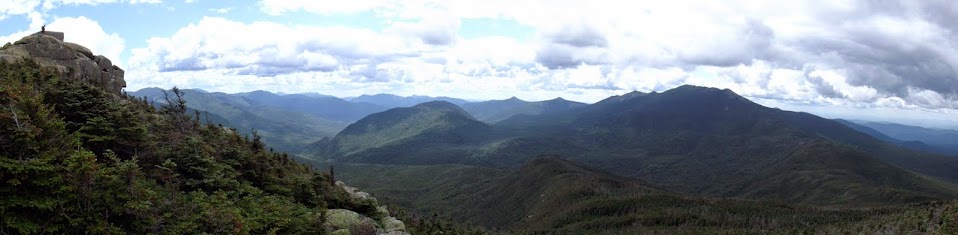
Panoram from the summit of Garfield (elevation 4500'). On the left is the high point with the old firetower foundation. Owl's Head is in the middle, anchoring the Pemigewasset Wilderness. Lafayette and Franconia Ridge is on the right.
The views over to the Twins and Mount Galehead, which was our next destination.

After a break on the summit we picked up and moved on. The trail down the other side is as steep down as it was heading up to Garfield.
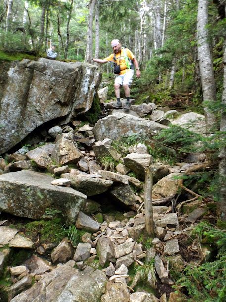
Brian heading down this section of the Garfield Ridge Trail that is pretty much a waterfall with substantial amounts of rain. A few winter's ago, it was a nice wet hike up.


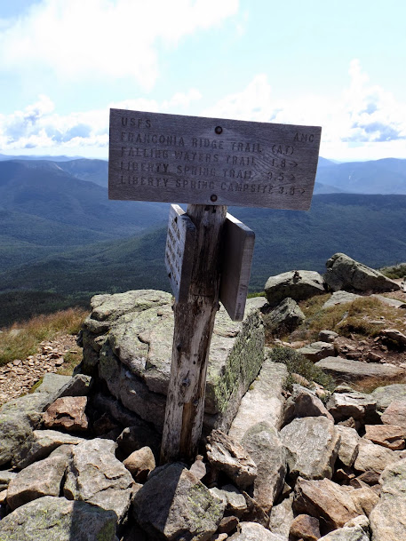
At the junction of the Garfield Ridge Trail and Franconia Brook Trail. As the sign says, we now have 2.2 miles across the ridge to get to the Galehead Hut.
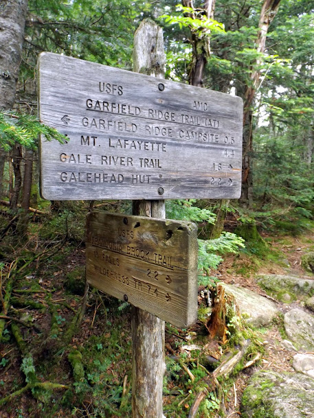
No surprise here. Like the rest of the ridge, it is wooded and the trail fairly well eroded.
On the way across the Garfield Ridge, we stopped at both Garfield Ridge Peaks (which are both on the NH 100 highest). This is the view from East Garfield Ridge (elevation 3590')as the West Peak's summit (elevation 3667') is wooded and viewless. Looking up to Galehead Mountain, the Galehead Hut and the Twinway.

Looking back to Franconia Ridge and Garfield from the summit of East Garfield Ridge Peak.

The views from the Galehead Hut are not quite as stunning as the Greenleaf Hut has, but they are still very nice.

Brian decided to stay at the hut as Joe and I made a run up to the summit of Mount Galehead. This is the cairn on what is considered the summit (elevation 4024').

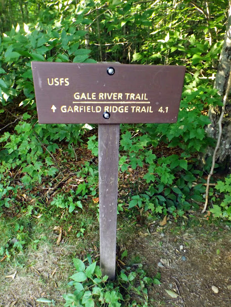
If you have ever been on the Gale River Trail, you know how utterly straight forward and boring it is. The only good thing the re-route did was help you avoid the water crossings, several of which that were difficult during high water times.
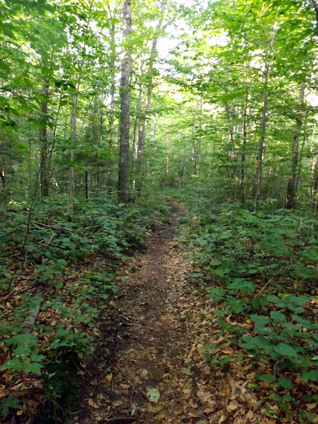
Almost out now. The trail this far down is pretty level and rather nicely rock free which helps a lot after of those miles climbing and descending rocky trails.
The end of the line (whew, finally!). We started this long hike a bit after 8:00 in the morning, and ended the day at about 6:30.
A long day of hiking and a bit tough on the knee's with all the ups and downs, but we managed to persevere. We got some decent mileage done, we managed to complete another full section of the Appalachian Trail and we got to hike with Joe (which has been rare lately; the same with Mike and Bob). The weather wasn't bad to boot and the bugs were pretty non-existent, except for on the summit's.
Already donated but want to do more? Can't donate but still want to help? "Like" and "share" our Facebook page. Even as little as a dollar helps. Even "sharing" with just one person does too by spreading the word. Our Donation Page is set up directly through the National Multiple Sclerosis Society website, so you can donate with confidence that 100% of the money goes to this fine collection of people working to help those stricken with MS.
Brian says "thumbs up to all who donate, or like and share on Facebook!" Hey, even if you like being silly, like our page!

No comments:
Post a Comment
We welcome all feedback so please feel free to comment or critique this site.