Elevation gain: 4957'
Trails used: Appalachian Trail (Wachipauka Pond, Townline, Glencliff, Beaver Brook)
For once we finally had a plan in place before the actual hike. No route variations, no bushwhacking and no trying to figure out what to do next. Brian had hiked the Wachipauka Pond Trail section with our friend Jim a few years ago (and I needed this section) but Brian needed the Beaver Brook section to complete that (which I had done several winters ago with our friend Joe). Making sense yet?!
This section of the AT would take us from NH25C, over Mount Mist and down to NH25. We then had road walk for about .10 miles to get to the Townline Trail, then cross Oliverian Brook and over to Long Pond Road. Another roadwalk on High Street and we jumped onto the Glencliff Trail with a stiff climb up Mount Moosilaukee. Finally, a somewhat unrelentingly steep climb down Beaver Brook Trail down to the parking area and salvation.
The hike started off on the cool side, with partly sunny skies and the usual bugs. We passed more SOBO's (southbounders) than we did NOBO's on this hike.
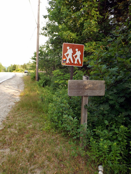
The start of the long haul to come. The trailhead off of NH25C.
The first section of trail was a proverbial walk in the woods.

The summit of Mount Mist (elevation 2230'). Not much to this summit.

Since we were on the Appalachian Trail, it was pretty easy to follow. White blazes keep you on trail. We did notice this section was very muddy.

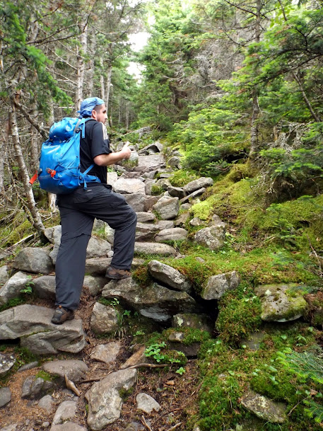
Greg awash in a sea of green.

The only view we would get from the first section of the hike overlooking Wachipauka Pond.

Walking along the last little stretch of trail to the road. We skipped the trails to Webster Slide and down to Wachipauka Pond to continue onward. Climbing over, up and back down for both would probably have added an extra two miles round trip and about 1000 feet of gain.

Here is the sign for the Wachipauka Pond Trail head on the NH25 side. We still had to cross Oliverian Brook on the other side of NH25 which was quite high, but we still managed to get across with a little ingenuity.

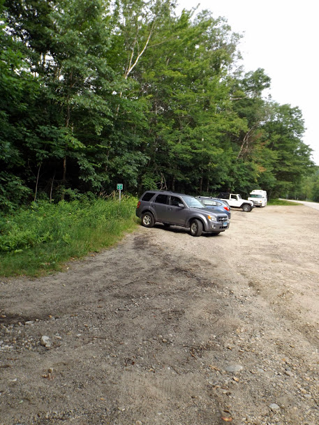
The parking lot is pretty full. There were lots of people out hiking the AT today!
The first 1/3 of the hike was all in the woods but it wasn't bad, elevation wise.

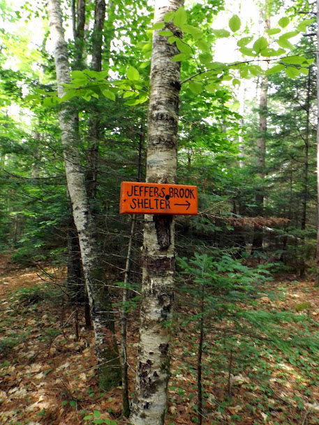
Sign pointing to the Jeffers Brook shelter.
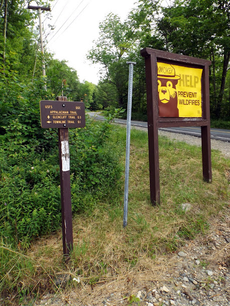
Smokey the Bear says help prevent forest fires. Oh, Glencliff is that way also.
Looking back towards where we started with Mount Mist (left) and Webster Slide (right).

The start of the Glencliff Trail which i dubbed Glencliff Mud Pit Trail.

A nice grassy area. Could you imagine all the ticks in there at this time of year.

Thankfully the Glencliff Trail turns into a road for a little ways.

We go up and up and up on Glencliff. It's one of those trails like Valley Way and Nineteen Mile Brook that you know you are going to get there but it will be boring as hell.

Greg gives this trail a hearty thumbs up...or not!
A slide on the side of the south peak of Moosilaukee. I tried climbing this slide a few years ago to no avail.

New trail signs at the junction for the Carriage Road to the summit of Moosilaukee, and several other trails that get you around the summit.

The trail on the way to the summit of Moosilaukee. Very gradual and easy all the way to the summit area.


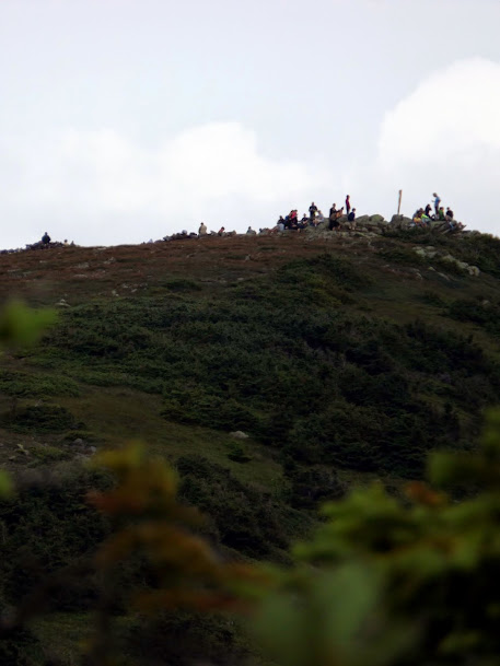
A zoom in of the the summit which was an utter zoo today!
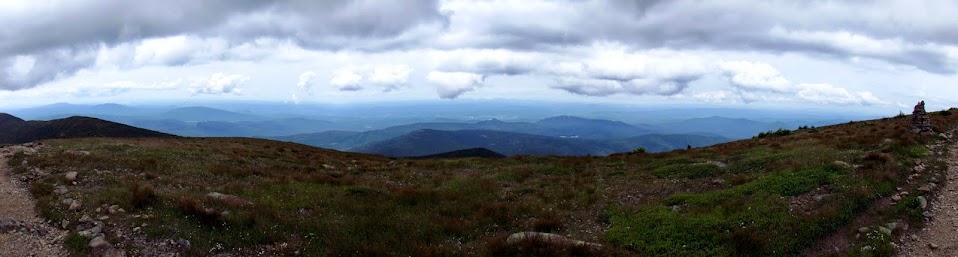
This panorama was approaching the summit where we got wonderful views.
The summit area of Mount Moosilaukee (elevation 4802').

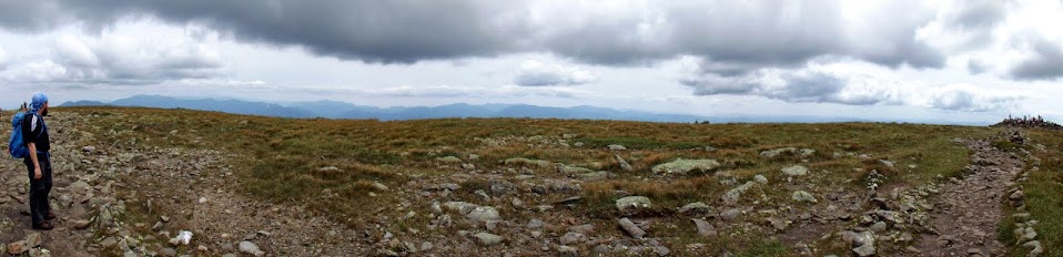
Panorama of the summit of Moosiluakee and the many people on its summit.

Looking south to Moosilaukee's south peak and other mountains.

Looking west to Black Mountain, Clough and the Hogsback.
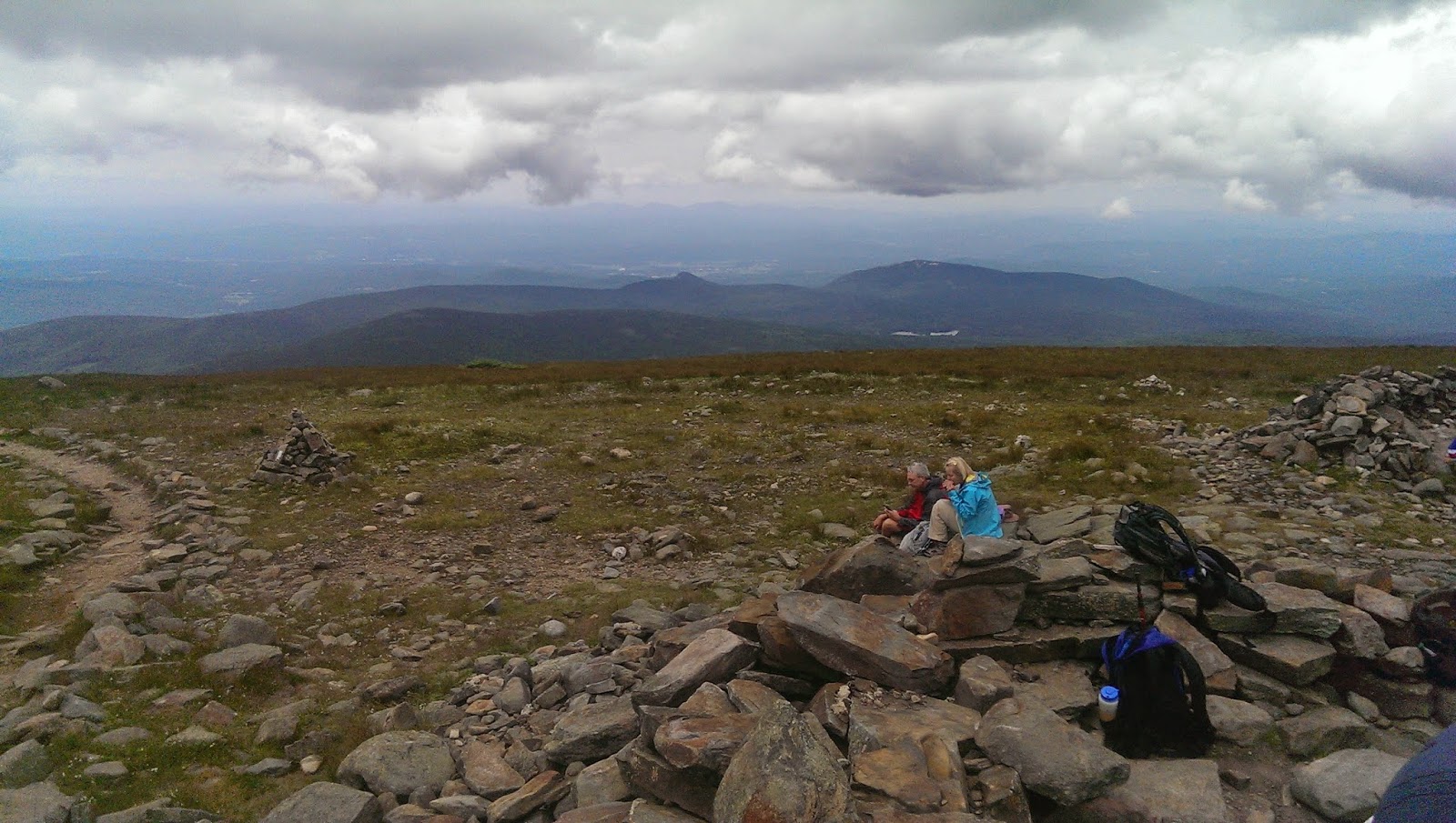
Looking back at the summit of Moosilaukee and the party going on at the summit.

Looking north to the Kinsmans, and Franconia Ridge.

Away from the summit things get quiet again. This is looking to the east and to the summit.
Nice wooded section just before the herd path for Mount Blue.

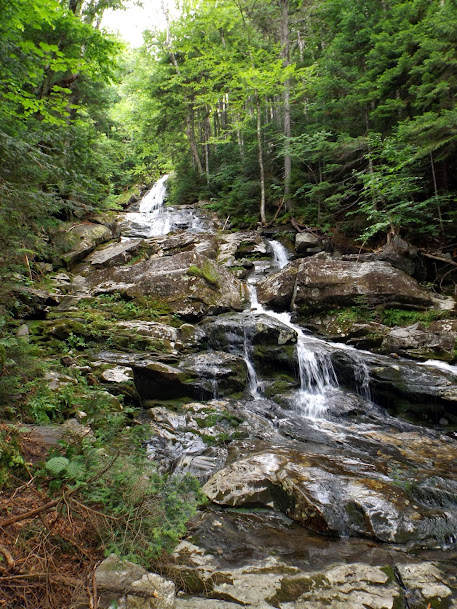
Time to head down the Beaver Brook Trail, the steepest, roughest 2 miles of hiking I've ever done besides Boott Spur.

A sample picture of the rocky mess you traverse on your way down to the parking area.

Greg enjoys a nice cold drink from a trail side spring.

More awesome steepness.

One of the neat things about this trail is the many cascades and waterfalls that you pass by on the way down/up that you could relax beside and enjoy on a warm day.


There were quite a few sections with wooden steps in the really steep spots, and a few had iron bars on the sides of rocks for one to hold onto.


The last of the falls before we finally make it off this steep trail.
Another section done for the Appalachian Trail in New Hampshire. If we concentrated what we have left for the rest of the year, we could be done in no time. Alas, there's never enough time to hike everything you want to hike in a given year. While the weather could have been better, we still managed to crank out some decent miles and do so with our usual swagger.
Already donated but want to do more? Can't donate but still want to help? "Like" and "share" our Facebook page. Even as little as a dollar helps. Even "sharing" with just one person does too by spreading the word. Our Donation Page is set up directly through the National Multiple Sclerosis Society website, so you can donate with confidence that 100% of the money goes to this fine collection of people working to help those stricken with MS.
Brian says "thumbs up to all who donate, or like and share on Facebook!" Hey, even if you like being silly, like our page!

No comments:
Post a Comment
We welcome all feedback so please feel free to comment or critique this site.